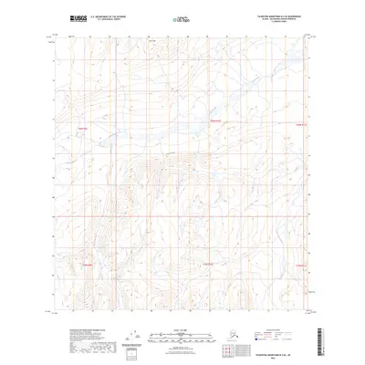
2023 Map of Talkeetna Mountains B-2 SE
USGS Topo · Published 2023About this map
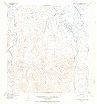
Oshetna River carves a broad valley through this high-altitude landscape in the Talkeetna Mountains. This 2023 survey illustrates the drainage patterns of the Matanuska-Susitna Borough, where Gold Creek and the Little Oshetna River serve as primary tributaries. The terrain is defined by the prominent Twin Hills in the northern reaches, surrounded by a complex network of glacial valleys and steep ridgelines. There are no roads or permanent structures recorded here, highlighting the wilderness character of the region. The map provides precise Public Land Survey System data across several townships, including t26n r10e and t25n r10e, which is essential for identifying specific land tracts and natural boundaries in this roadless portion of the Alaskan interior.
Find a feature on this map
10 named features on this map. Tap any name to fly to it.
Don’t see what you’re looking for? This feature index may not catch every label — zoom into the map to look around manually.
Map Details
Editions of this 2023 Talkeetna Mountains B-2 SE Map
This is the sole edition of this map. No revisions or reprints were ever made.
Other maps of this area

1949 · Talkeetna Mountains A-1
USGS Topo · 1:63,360

1950 · Talkeetna Mountains
USGS Topo · 1:250,000

1951 · Talkeetna Mountains B-1
USGS Topo · 1:63,360

1951 · Talkeetna Mountains A-2
USGS Topo · 1:63,360

1951 · Talkeetna Mountains B-2
USGS Topo · 1:63,360
1952 · Talkeetna Mountains A-1
USGS Topo · 1:63,360
1952 · Talkeetna Mountains A-2
USGS Topo · 1:63,360
1952 · Talkeetna Mountains B-2
USGS Topo · 1:63,360
1952 · Talkeetna Mountains B-1
USGS Topo · 1:63,360

1954 · Talkeetna Mountains
USGS Topo · 1:250,000