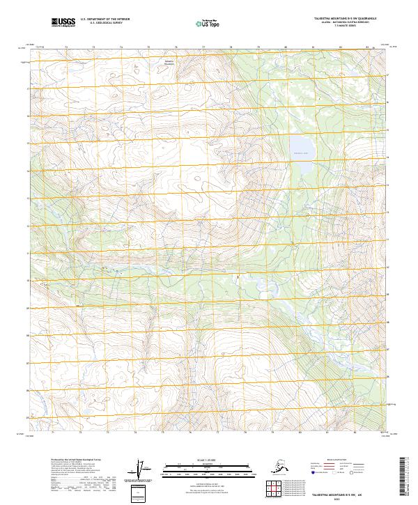
2023 Map of Talkeetna Mountains B-5 SW
USGS Topo · Published 2023About this map
Talkeetna Mountains terrain dominates this 2023 survey of the Alaskan interior, where glacial drainage patterns define the landscape. The Sheep River carves a significant path through the southern half of the quadrangle, joined by the Middle Fork Montana Creek in the southwest corner. To the northeast, the elevation gives way to Iron Creek and the notable high-altitude Rainbow Lake. This map represents a pristine wilderness area within the Matanuska-Susitna Borough, showing the complex contouring of the peaks and valleys as they were documented in the early 21st century. The absence of roads or permanent settlements highlights the isolated nature of these drainage basins, which remain critical for understanding the local hydrology and topographical shifts in this part of the range.
Find a feature on this map
8 named features on this map. Tap any name to fly to it.
Don’t see what you’re looking for? This feature index may not catch every label — zoom into the map to look around manually.
Map Details
Editions of this 2023 Talkeetna Mountains B-5 SW Map
This is the sole edition of this map. No revisions or reprints were ever made.
Other maps of this area

1949 · Talkeetna Mountains B-6
USGS Topo · 1:63,360

1950 · Talkeetna Mountains
USGS Topo · 1:250,000

1950 · Talkeetna Mountains B-5
USGS Topo · 1:63,360

1950 · Talkeetna Mountains A-6
USGS Topo · 1:63,360

1950 · Talkeetna Mountains A-5
USGS Topo · 1:63,360

1952 · Talkeetna Mountains B-6
USGS Topo · 1:63,360
1952 · Talkeetna Mountains B-5
USGS Topo · 1:63,360
1952 · Talkeetna Mountains A-5
USGS Topo · 1:63,360
1952 · Talkeetna Mountains A-6
USGS Topo · 1:63,360

1954 · Talkeetna Mountains
USGS Topo · 1:250,000