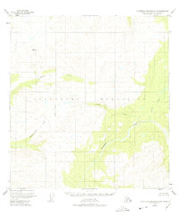
1950 Map of Talkeetna Mountains C-5
USGS Topo · Published 1975About this map
The Talkeetna River winds through the southeastern portion of this 1950 survey, cutting through the high elevation of the Talkeetna Mountains. This mid-century map captures an era when large sections of the Alaskan interior remained unsurveyed and unmarked on the ground, with land lines predetermined by the Bureau of Land Management along the Seward Meridian. The drainage system is the dominant characteristic of this landscape, defined by major tributaries including Chunilna Creek in the north and Prairie Creek to the east. Smaller watercourses such as Cache Creek and the curiously named Disappointment Creek reveal the network of valleys that guided early travel and resource exploration in the Matanuska-Susitna region before the development of modern roads or permanent settlements in this specific quadrangle.
Find a feature on this map
7 named features on this map. Tap any name to fly to it.
Don’t see what you’re looking for? This feature index may not catch every label — zoom into the map to look around manually.
Map Details
Editions of this 1950 Talkeetna Mountains C-5 Map
2 editions found
Other maps of this area

1949 · Talkeetna Mountains D-6
USGS Topo · 1:63,360

1949 · Talkeetna Mountains B-6
USGS Topo · 1:63,360

1949 · Talkeetna Mountains C-6
USGS Topo · 1:63,360

1950 · Talkeetna Mountains
USGS Topo · 1:250,000

1950 · Talkeetna Mountains B-5
USGS Topo · 1:63,360

1950 · Talkeetna Mountains B-4
USGS Topo · 1:63,360

1950 · Talkeetna Mountains D-5
USGS Topo · 1:63,360

1950 · Talkeetna Mountains C-5
USGS Topo · 1:63,360

1951 · Talkeetna Mountains D-5
USGS Topo · 1:63,360

1951 · Talkeetna Mountains C-4
USGS Topo · 1:63,360