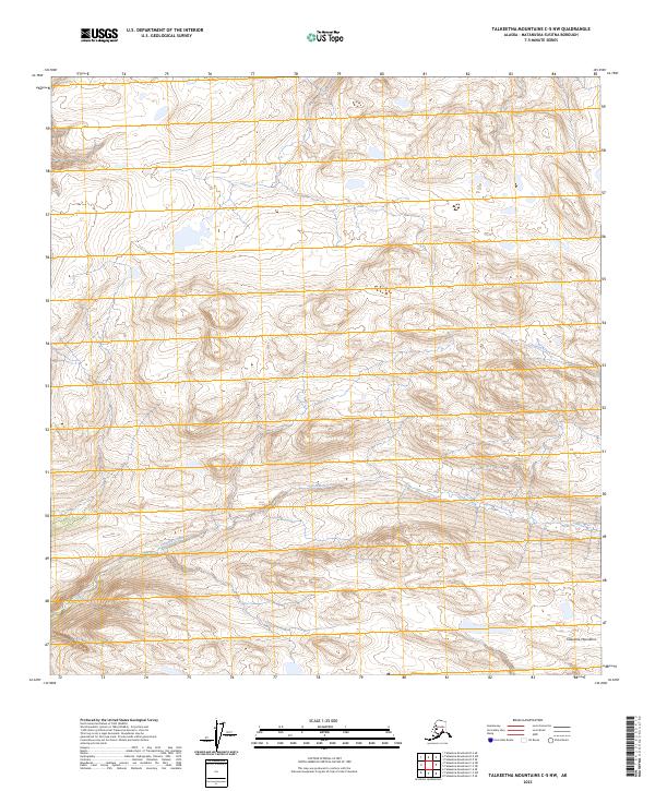
2023 Map of Talkeetna Mountains C-5 NW
USGS Topo · Published 2023About this map
The Talkeetna Mountains define the high-elevation landscape of this interior Alaskan region, as detailed by this 2023 U.S. Geological Survey topographic study. This specific area is dominated by the winding course of Chunilna Creek, which cuts through the mountainous terrain as it flows across multiple township boundaries. The map provides a high-resolution look at the drainage patterns and significant relief within the Matanuska-Susitna Borough, reflecting the contemporary hydrological and contour data from the National Hydrography and Elevation Datasets. While the region lacks permanent settlements or road infrastructure, the precise plotting of Chunilna Creek and the surrounding peaks offers critical detail for those studying the remote wilderness and public land systems of the northern Talkeetna range.
Find a feature on this map
8 named features on this map. Tap any name to fly to it.
Don’t see what you’re looking for? This feature index may not catch every label — zoom into the map to look around manually.
Map Details
Editions of this 2023 Talkeetna Mountains C-5 NW Map
This is the sole edition of this map. No revisions or reprints were ever made.
Other maps of this area

1949 · Talkeetna Mountains D-6
USGS Topo · 1:63,360

1949 · Talkeetna Mountains C-6
USGS Topo · 1:63,360

1950 · Talkeetna Mountains
USGS Topo · 1:250,000

1950 · Talkeetna Mountains D-5
USGS Topo · 1:63,360

1950 · Talkeetna Mountains C-5
USGS Topo · 1:63,360

1951 · Talkeetna Mountains D-5
USGS Topo · 1:63,360

1951 · Talkeetna Mountains D-6
USGS Topo · 1:63,360

1952 · Talkeetna Mountains C-6
USGS Topo · 1:63,360

1952 · Talkeetna Mountains D-6
USGS Topo · 1:63,360
1952 · Talkeetna Mountains C-5
USGS Topo · 1:63,360