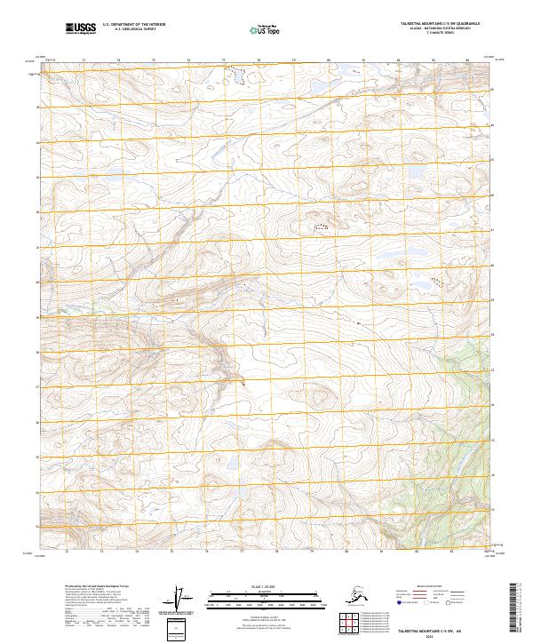
2023 Map of Talkeetna Mountains C-5 SW
USGS Topo · Published 2023About this map
Talkeetna River winds through the southeastern corner of this Alaskan interior landscape, a remote section of the Matanuska-Susitna Borough where the water systems define the geography. The drainage patterns are dictated by the paths of Disappointment Creek and Cache Creek, which carve through the high-elevation terrain before meeting larger valley floors. This area is predominantly characterized by its hydrographic network rather than permanent settlements, illustrating a pristine wilderness state as documented in the early 21st century. The map provides clear delineation of the Public Land Survey System, marking the intersections of t29n r1w, t29n r1e, t28n r1w, and t28n r1e, which serve as the primary navigational and legal framework for this uninhabited reach of the Talkeetna Mountains.
Find a feature on this map
7 named features on this map. Tap any name to fly to it.
Don’t see what you’re looking for? This feature index may not catch every label — zoom into the map to look around manually.
Map Details
Editions of this 2023 Talkeetna Mountains C-5 SW Map
This is the sole edition of this map. No revisions or reprints were ever made.
Other maps of this area

1949 · Talkeetna Mountains B-6
USGS Topo · 1:63,360

1949 · Talkeetna Mountains C-6
USGS Topo · 1:63,360

1950 · Talkeetna Mountains
USGS Topo · 1:250,000

1950 · Talkeetna Mountains B-5
USGS Topo · 1:63,360

1950 · Talkeetna Mountains C-5
USGS Topo · 1:63,360

1952 · Talkeetna Mountains C-6
USGS Topo · 1:63,360

1952 · Talkeetna Mountains B-6
USGS Topo · 1:63,360
1952 · Talkeetna Mountains B-5
USGS Topo · 1:63,360
1952 · Talkeetna Mountains C-5
USGS Topo · 1:63,360

1954 · Talkeetna Mountains
USGS Topo · 1:250,000