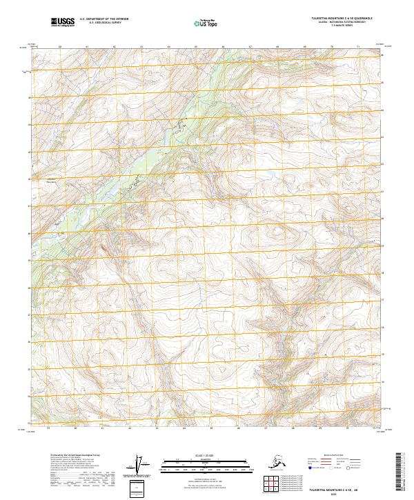
2023 Map of Talkeetna Mountains C-6 SE
USGS Topo · Published 2023About this map
The high alpine interior of the Talkeetna Mountains defines this 2023 survey in the Matanuska-Susitna Borough. Dominated by a complex network of ridgelines and drainages, the map documents the natural hydrology of the region as it exists in the early 21st century. Chunilna Creek serves as the primary artery through this portion of the range, winding through the western and central sections of the quadrangle. In the eastern reaches, the headwaters of Disappointment Creek emerge, carving through the high-elevation terrain. This modern USGS study provides a precise record of these undeveloped mountain valleys, where the landscape is shaped entirely by the seasonal flow of glacial-fed waters and the steep contours of the subarctic wilderness. The absence of roads or established settlements emphasizes the remote character of this high-latitude terrain.
Find a feature on this map
9 named features on this map. Tap any name to fly to it.
Don’t see what you’re looking for? This feature index may not catch every label — zoom into the map to look around manually.
Map Details
Editions of this 2023 Talkeetna Mountains C-6 SE Map
This is the sole edition of this map. No revisions or reprints were ever made.
Other maps of this area

1949 · Talkeetna Mountains B-6
USGS Topo · 1:63,360

1949 · Talkeetna Mountains C-6
USGS Topo · 1:63,360

1950 · Talkeetna Mountains
USGS Topo · 1:250,000

1950 · Talkeetna Mountains B-5
USGS Topo · 1:63,360

1950 · Talkeetna Mountains C-5
USGS Topo · 1:63,360

1952 · Talkeetna Mountains C-6
USGS Topo · 1:63,360

1952 · Talkeetna Mountains B-6
USGS Topo · 1:63,360
1952 · Talkeetna Mountains B-5
USGS Topo · 1:63,360
1952 · Talkeetna Mountains C-5
USGS Topo · 1:63,360

1954 · Talkeetna Mountains
USGS Topo · 1:250,000