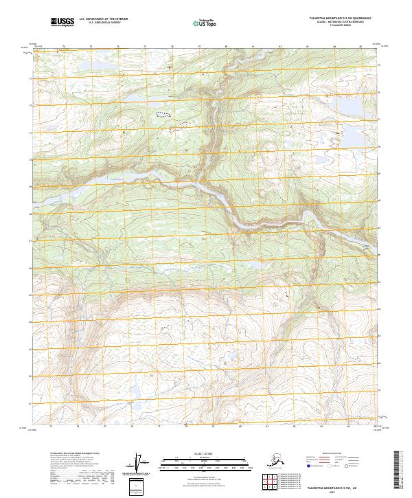
2023 Map of Talkeetna Mountains D-5 SW
USGS Topo · Published 2023About this map
Susitna River carves a significant course through this portion of the Susitna Valley, punctuated by the dramatic narrowing of Devils Canyon. This modern topographic survey highlights a wilderness landscape shaped by steep elevation changes and powerful glacial waterways. The confluence of Portage Creek and the river occurs just upstream of the canyon, a geographic bottleneck that has historically dictated navigation and movement through this remote interior corridor. The map provides a precise look at the land survey system, including townships like t32n r1w and t31n r1e, which define the administrative boundaries in an otherwise untamed terrain of high ridges and narrow creek valleys.
Find a feature on this map
8 named features on this map. Tap any name to fly to it.
Don’t see what you’re looking for? This feature index may not catch every label — zoom into the map to look around manually.
Map Details
Editions of this 2023 Talkeetna Mountains D-5 SW Map
This is the sole edition of this map. No revisions or reprints were ever made.
Other maps of this area

1949 · Talkeetna Mountains D-6
USGS Topo · 1:63,360

1949 · Talkeetna Mountains C-6
USGS Topo · 1:63,360

1950 · Talkeetna Mountains
USGS Topo · 1:250,000

1950 · Talkeetna Mountains D-5
USGS Topo · 1:63,360

1950 · Talkeetna Mountains C-5
USGS Topo · 1:63,360

1951 · Talkeetna Mountains D-5
USGS Topo · 1:63,360

1951 · Talkeetna Mountains D-6
USGS Topo · 1:63,360

1952 · Talkeetna Mountains C-6
USGS Topo · 1:63,360

1952 · Talkeetna Mountains D-6
USGS Topo · 1:63,360
1952 · Talkeetna Mountains C-5
USGS Topo · 1:63,360