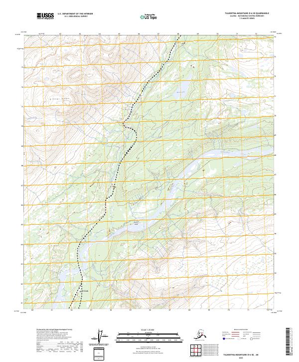
2023 Map of Talkeetna Mountains D-6 SE
USGS Topo · Published 2023About this map
The Susitna River carves a broad path through this Matanuska-Susitna region, forming the central corridor of the Susitna Valley. This landscape is defined by the sharp transition between the river lowlands and the high elevations of K'esugi Ridge to the northwest. The settlement at Gold Creek serves as a primary point of reference in the southern portion of the sheet, situated near the confluence of its namesake Gold Creek and the main river channel. Numerous tributaries, including the Indian River, Byers Creek, and Salmon Creek, drain the high country, creating a complex network of waterways that support the region's diverse wetlands. The presence of Miami Lake and high-altitude markers like Kesugi Ridge Tri provide clear landmarks for navigating the dramatic elevation changes characteristic of this Alaskan wilderness.
Find a feature on this map
16 named features on this map. Tap any name to fly to it.
Don’t see what you’re looking for? This feature index may not catch every label — zoom into the map to look around manually.
Map Details
Editions of this 2023 Talkeetna Mountains D-6 SE Map
This is the sole edition of this map. No revisions or reprints were ever made.
Other maps of this area

1949 · Talkeetna Mountains D-6
USGS Topo · 1:63,360

1949 · Talkeetna Mountains C-6
USGS Topo · 1:63,360

1950 · Talkeetna Mountains
USGS Topo · 1:250,000

1950 · Talkeetna Mountains D-5
USGS Topo · 1:63,360

1950 · Talkeetna Mountains C-5
USGS Topo · 1:63,360

1951 · Talkeetna Mountains D-5
USGS Topo · 1:63,360

1951 · Talkeetna Mountains D-6
USGS Topo · 1:63,360

1952 · Talkeetna Mountains C-6
USGS Topo · 1:63,360

1952 · Talkeetna Mountains D-6
USGS Topo · 1:63,360
1952 · Talkeetna Mountains C-5
USGS Topo · 1:63,360