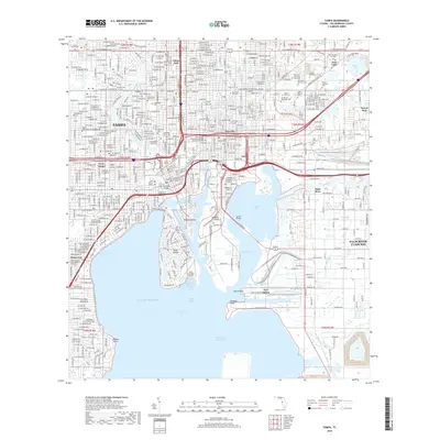
2018 Map of Tampa
USGS Topo · Published 2018About this map
Tampa's complex urban shoreline and industrial waterfront dominate this 2018 survey, reflecting a modern metropolis deeply tied to its maritime origins. The intricate geography of Hillsborough Bay is defined by engineered landforms and deep-water channels, including Hookers Point and Harbour Island. The dense grid of Ybor City transitions into the logistics-heavy corridor of Gary, where shipping channels like the Ybor Channel meet rail and road networks.
Find a feature on this map
66 named features on this map. Tap any name to fly to it.
Don’t see what you’re looking for? This feature index may not catch every label — zoom into the map to look around manually.
Map Details
Editions of this 2018 Tampa Map
This is the sole edition of this map. No revisions or reprints were ever made.
Other maps of this area

1921 · Tampa
USGS Topo · 1:62,500

1921 · St Petersburg
USGS Topo · 1:62,500

1943 · Gandy Bridge
USGS Topo · 1:31,680

1943 · Port Tampa
USGS Topo · 1:31,680

1943 · Thonotosassa
USGS Topo · 1:24,000

1944 · Sulphur Springs
USGS Topo · 1:31,680

1944 · Mango
USGS Topo · 1:31,680

1944 · Tampa
USGS Topo · 1:31,680

1944 · Thonotosassa
USGS Topo · 1:31,680

1944 · Balm
USGS Topo · 1:31,680