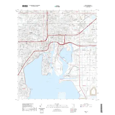
2021 Map of Tampa
USGS Topo · Published 2021About this map
Ybor City stands as a testament to the industrial and cultural evolution of the Florida Gulf Coast, its grid dense with history from the cigar industry to modern revitalization. This survey details the urban core of Tampa, where the Hillsborough River meets the complex waterfront of Hillsborough Bay. The mapping captures the sophisticated maritime infrastructure of Ybor Channel and Garrison Channel, which define the edges of Harbour Island and the residential reach of Davis Islands.
Find a feature on this map
193 named features on this map. Tap any name to fly to it.
Don’t see what you’re looking for? This feature index may not catch every label — zoom into the map to look around manually.
Map Details
Editions of this 2021 Tampa Map
This is the sole edition of this map. No revisions or reprints were ever made.
Other maps of this area

1921 · Tampa
USGS Topo · 1:62,500

1921 · St Petersburg
USGS Topo · 1:62,500

1943 · Gandy Bridge
USGS Topo · 1:31,680

1943 · Port Tampa
USGS Topo · 1:31,680

1943 · Thonotosassa
USGS Topo · 1:24,000

1944 · Sulphur Springs
USGS Topo · 1:31,680

1944 · Mango
USGS Topo · 1:31,680

1944 · Tampa
USGS Topo · 1:31,680

1944 · Thonotosassa
USGS Topo · 1:31,680

1944 · Balm
USGS Topo · 1:31,680