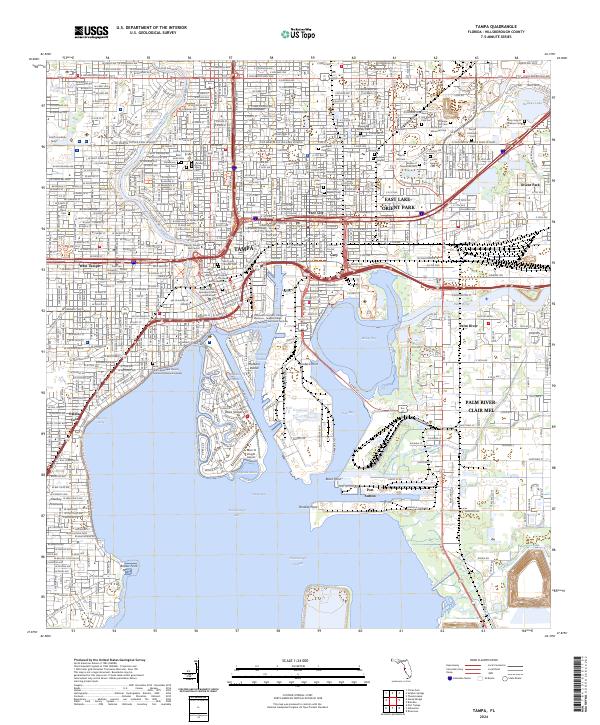
2024 Map of Tampa
USGS Topo · Published 2024About this map
The Hillsborough River flows through the urban heart of Tampa, providing a central axis for this coastal Florida landscape. The map highlights the city's complex waterfront, where the industrial infrastructure of Hookers Point and Port Sutton contrasts with the residential development of Davis Islands. A dense network of cultural and genealogical sites is concentrated in the northeast, including a notable cluster of ethnic and community burial grounds such as Centro Asturiano Cem, Italian Club Cem, and Beth Israel Cem.
Find a feature on this map
90 named features on this map. Tap any name to fly to it.
Don’t see what you’re looking for? This feature index may not catch every label — zoom into the map to look around manually.
Map Details
Editions of this 2024 Tampa Map
This is the sole edition of this map. No revisions or reprints were ever made.
Other maps of this area

1921 · Tampa
USGS Topo · 1:62,500

1921 · St Petersburg
USGS Topo · 1:62,500

1943 · Gandy Bridge
USGS Topo · 1:31,680

1943 · Port Tampa
USGS Topo · 1:31,680

1943 · Thonotosassa
USGS Topo · 1:24,000

1944 · Sulphur Springs
USGS Topo · 1:31,680

1944 · Mango
USGS Topo · 1:31,680

1944 · Tampa
USGS Topo · 1:31,680

1944 · Thonotosassa
USGS Topo · 1:31,680

1944 · Balm
USGS Topo · 1:31,680