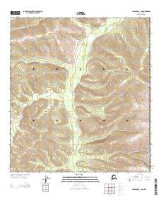
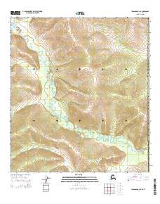
2013 Map of Tanacross A-1 NE
USGS Topo · Published 2013About this map
McArthur Creek flows through the central portion of this remote borderland, marking a landscape defined by significant elevation changes and the high terrain of Moosehorn Ridge in the east. This 2013 survey is situated along the international boundary between the United States and Canada, capturing a rugged stretch of the Southeast Fairbanks census area. The map illustrates a wilderness mostly devoid of modern infrastructure, where the natural topography dictates the character of the land. Geographic lines of the Public Land Survey System, such as Township 17 North and Range 23 East, provide the primary framework for orientation across this mountainous interior. The isolation of the terrain suggests a region focused on natural resource navigation rather than permanent settlement.
Find a feature on this map
9 named features on this map. Tap any name to fly to it.
Don’t see what you’re looking for? This feature index may not catch every label — zoom into the map to look around manually.
Map Details
Editions of this 2013 Tanacross A-1 NE Map
This is the sole edition of this map. No revisions or reprints were ever made.
Other maps of this area

1949 · Tanacross
USGS Topo · 1:250,000

1950 · Tanacross
USGS Topo · 1:250,000

1952 · Tanacross A-1
USGS Topo · 1:63,360
1956 · Tanacross B-1
USGS Topo · 1:63,360

1956 · Tanacross
USGS Topo · 1:250,000

1964 · Tanacross
USGS Topo · 1:250,000

2013 · Tanacross A-1 NW
USGS Topo · 1:25,000
2013 · Tanacross A-1 SE
USGS Topo · 1:25,000
2013 · Tanacross A-1 SW
USGS Topo · 1:25,000
2015 · Tanacross B-1 SE
USGS Topo · 1:25,000