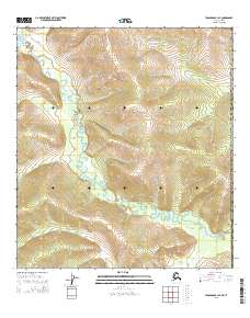
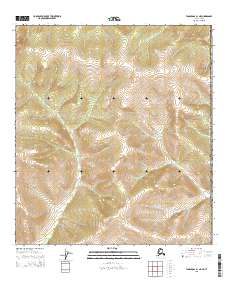
2015 Map of Tanacross B-1 SE
USGS Topo · Published 2015About this map
The Ladue River winds extensively through this portion of the Alaska Southeast Fairbanks Census Area, creating a complex network of oxbows and meanders across the valley floor. This 2015 U.S. Geological Survey data illustrates a landscape defined by dramatic elevation changes, where the river basin is tightly hemmed in by steep, unnamed ridges that rise several hundred feet above the water level. In the southeastern corner, McArthur Cr enters the frame, marking a transition in the drainage pattern near the international border. The map provides a precise record of the Public Land Survey System divisions, including t18n r22e and t18n r23e, which are essential for identifying land tracts and historical claims in this interior wilderness. The absence of roads or established settlements emphasizes the isolated character of the upper Yukon river systems during the early twenty-first century.
Find a feature on this map
8 named features on this map. Tap any name to fly to it.
Don’t see what you’re looking for? This feature index may not catch every label — zoom into the map to look around manually.
Map Details
Editions of this 2015 Tanacross B-1 SE Map
This is the sole edition of this map. No revisions or reprints were ever made.
Other maps of this area

1949 · Tanacross
USGS Topo · 1:250,000

1950 · Tanacross
USGS Topo · 1:250,000

1952 · Tanacross A-1
USGS Topo · 1:63,360
1956 · Tanacross B-1
USGS Topo · 1:63,360

1956 · Tanacross
USGS Topo · 1:250,000

1964 · Tanacross
USGS Topo · 1:250,000

2013 · Tanacross A-1 NW
USGS Topo · 1:25,000
2013 · Tanacross A-1 NE
USGS Topo · 1:25,000
2015 · Tanacross B-1 SW
USGS Topo · 1:25,000
2015 · Tanacross B-1 NE
USGS Topo · 1:25,000