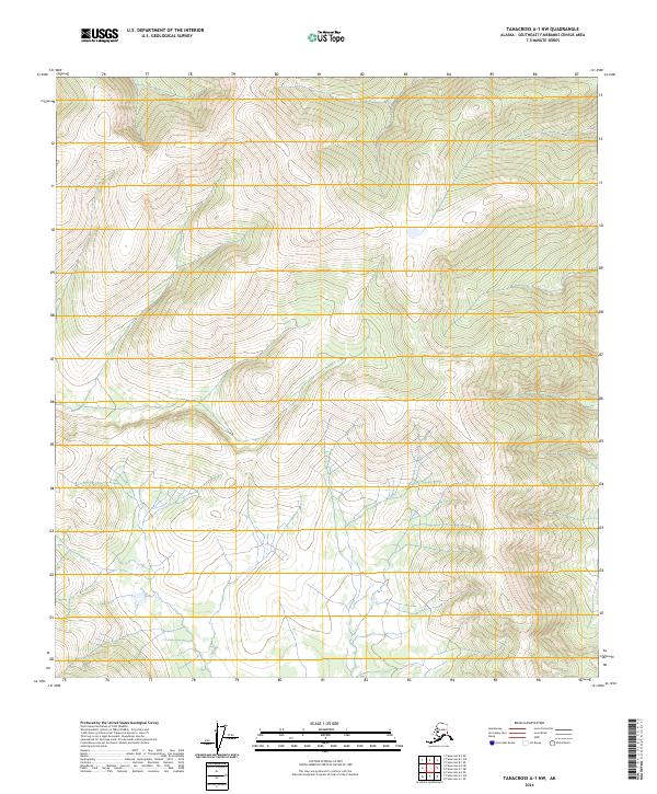
2024 Map of Tanacross A-1 NW
USGS Topo · Published 2024About this map
Steep ridges and deep drainages define this portion of the Southeast Fairbanks Census Area, where the landscape is structured by the Public Land Survey System divisions of T17n R21e and T16n R21e. Produced by the U.S. Geological Survey, this 2024 quadrangle depicts a high-elevation interior with a contour interval of 20 feet, revealing the complex relief of the Alaskan wilderness. The map focuses on the physical geography of the region, including the western edge of T17n R22e and T16n R22e. While devoid of named settlements or man-made landmarks, the sheet provides essential data on the hydrologic patterns and natural terrain features that dominate this remote part of the state, serving as a contemporary reference for land management and navigation.
Find a feature on this map
5 named features on this map. Tap any name to fly to it.
Don’t see what you’re looking for? This feature index may not catch every label — zoom into the map to look around manually.
Map Details
Editions of this 2024 Tanacross A-1 NW Map
This is the sole edition of this map. No revisions or reprints were ever made.
Other maps of this area

1949 · Tanacross
USGS Topo · 1:250,000

1950 · Tanacross
USGS Topo · 1:250,000

1952 · Tanacross A-1
USGS Topo · 1:63,360

1954 · Tanacross A-2
USGS Topo · 1:63,360

1955 · Tanacross A-2
USGS Topo · 1:63,360
1956 · Tanacross B-1
USGS Topo · 1:63,360
1956 · Tanacross B-2
USGS Topo · 1:63,360

1956 · Tanacross
USGS Topo · 1:250,000

1964 · Tanacross
USGS Topo · 1:250,000

2013 · Tanacross A-1 NW
USGS Topo · 1:25,000