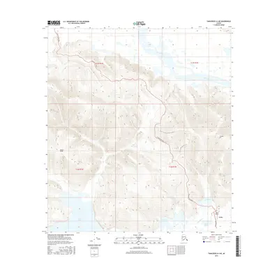
2016 Map of Tanacross A-4 NE
USGS Topo · Published 2016About this map
The Tetlin settlement serves as the focal point of this interior Alaskan landscape, situated where the Tetlin River winds toward the northern wetlands. The terrain is defined by the transition from the braided reaches of the Tanana River in the north to the foothills of the Alaska Range and the prominence of Chisana Mtn in the southeast. Transportation infrastructure is sparse but critical, primarily consisting of the Tetlin Access Road and Church Road, which connect the village and the Tetlin Airport to the broader region. Water dominates the lowland areas, with significant bodies such as Tetlin Lake, Sun Lake, and Skate Lake interspersed among the complex hydrology of the river basin. This survey provides a clear view of a subsistence-oriented geography where life is organized around the intersection of the river systems and the high ground of the surrounding mountains.
Find a feature on this map
18 named features on this map. Tap any name to fly to it.
Don’t see what you’re looking for? This feature index may not catch every label — zoom into the map to look around manually.
Map Details
Editions of this 2016 Tanacross A-4 NE Map
This is the sole edition of this map. No revisions or reprints were ever made.
Other maps of this area

1948 · Tanacross A-3
USGS Topo · 1:63,360

1948 · Tanacross A-4
USGS Topo · 1:63,360

1948 · Tanacross B-3
USGS Topo · 1:63,360

1949 · Tanacross
USGS Topo · 1:250,000

1949 · Tanacross B-4
USGS Topo · 1:63,360

1949 · Tanacross B-3
USGS Topo · 1:63,360

1950 · Tanacross
USGS Topo · 1:250,000

1951 · Tanacross B-4
USGS Topo · 1:63,360

1952 · Tanacross A-4
USGS Topo · 1:63,360

1952 · Tanacross A-3
USGS Topo · 1:63,360