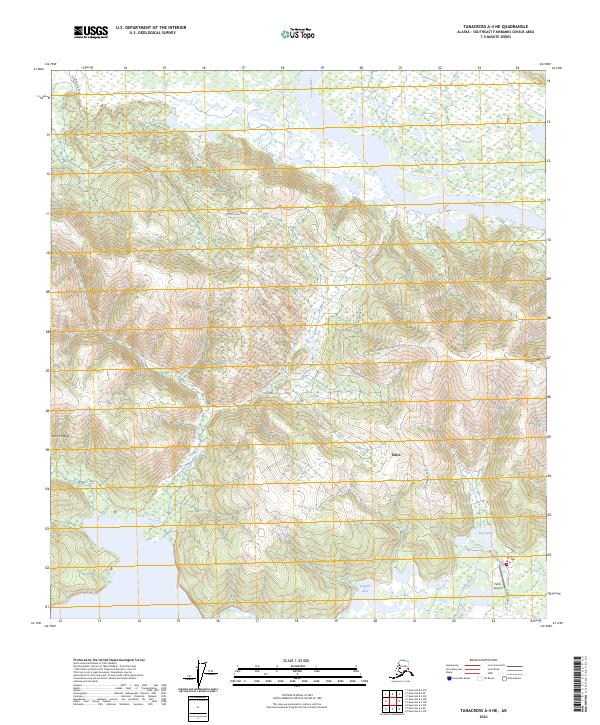
2024 Map of Tanacross A-4 NE
USGS Topo · Published 2024About this map
Tetlin serves as the primary hub in this interior Alaskan landscape, positioned along the banks of the Tetlin River. The surrounding terrain is defined by the broad corridors of the Tanana River and the rising elevations of the Alaska Range and Chisana Mtn. Transportation in this remote area is facilitated by the Tetlin Access Road and the Tetlin Airport, highlighting the essential infrastructure required for travel between isolated settlements. Local landmarks like Sun Lake, Logging Lake, and Church Road provide a detailed look at the geography and land use within the Southeast Fairbanks Census Area. The map illustrates the convergence of river systems and mountain foothills, where wetlands and waterways dominate the lower elevations, reflecting the seasonal and environmental rhythms of the Tanacross region.
Find a feature on this map
15 named features on this map. Tap any name to fly to it.
Don’t see what you’re looking for? This feature index may not catch every label — zoom into the map to look around manually.
Map Details
Editions of this 2024 Tanacross A-4 NE Map
This is the sole edition of this map. No revisions or reprints were ever made.
Other maps of this area

1948 · Tanacross A-3
USGS Topo · 1:63,360

1948 · Tanacross A-4
USGS Topo · 1:63,360

1948 · Tanacross B-3
USGS Topo · 1:63,360

1949 · Tanacross
USGS Topo · 1:250,000

1949 · Tanacross B-4
USGS Topo · 1:63,360

1949 · Tanacross B-3
USGS Topo · 1:63,360

1950 · Tanacross
USGS Topo · 1:250,000

1951 · Tanacross B-4
USGS Topo · 1:63,360

1952 · Tanacross A-4
USGS Topo · 1:63,360

1952 · Tanacross A-3
USGS Topo · 1:63,360