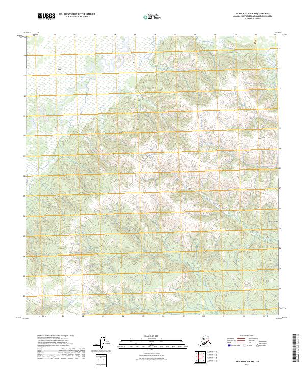
2024 Map of Tanacross A-4 NW
USGS Topo · Published 2024About this map
The Tok River winds through the northwestern corner of this interior Alaska landscape, carving a path through a vast expanse of wetlands and low-lying terrain. This 2024 survey documents the meeting point between the massive Alaska Range to the southeast and the rising Tetlin Hills. The map provides a meticulous record of the hydrography and elevation at the edge of the Southeast Fairbanks Census Area, where the braided river systems and complex topography illustrate the wild character of the Tanacross region. While the map is devoid of modern infrastructure or permanent settlements, it offers an essential baseline for understanding the natural drainage patterns and the transition from river valley to high ridge in this section of the subarctic wilderness.
Find a feature on this map
7 named features on this map. Tap any name to fly to it.
Don’t see what you’re looking for? This feature index may not catch every label — zoom into the map to look around manually.
Map Details
Editions of this 2024 Tanacross A-4 NW Map
This is the sole edition of this map. No revisions or reprints were ever made.
Other maps of this area

1948 · Tanacross B-5
USGS Topo · 1:63,360

1948 · Tanacross A-4
USGS Topo · 1:63,360

1948 · Tanacross A-5
USGS Topo · 1:63,360

1949 · Tanacross
USGS Topo · 1:250,000

1949 · Tanacross B-4
USGS Topo · 1:63,360

1949 · Tanacross A-5
USGS Topo · 1:63,360

1950 · Tanacross
USGS Topo · 1:250,000

1951 · Tanacross B-4
USGS Topo · 1:63,360

1952 · Tanacross A-4
USGS Topo · 1:63,360

1952 · Tanacross B-5
USGS Topo · 1:63,360