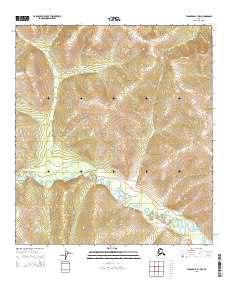
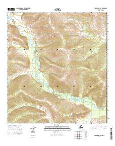
2015 Map of Tanacross B-1 NW
USGS Topo · Published 2015About this map
The Ladue River meanders through this remote interior Alaskan landscape, characterized by complex drainage patterns and significant elevation changes. This 2015 study focuses on the Ladue River basin and its tributary, Chicken Cr, illustrating the rugged topography of the Tanacross region. The map provides a high-resolution look at the natural hydrology of the area, where subtle watercourses cut through prominent ridgelines. While no permanent settlements are indicated, the detailed contouring reveals the intricate physical geography of this subarctic wilderness, where elevation benchmarks and section lines serve as the primary markers of human presence in a largely untouched environment.
Find a feature on this map
11 named features on this map. Tap any name to fly to it.
Don’t see what you’re looking for? This feature index may not catch every label — zoom into the map to look around manually.
Map Details
Editions of this 2015 Tanacross B-1 NW Map
This is the sole edition of this map. No revisions or reprints were ever made.
Other maps of this area

1949 · Tanacross
USGS Topo · 1:250,000

1950 · Tanacross
USGS Topo · 1:250,000

1956 · Tanacross C-1
USGS Topo · 1:63,360
1956 · Tanacross B-1
USGS Topo · 1:63,360

1956 · Tanacross C-2
USGS Topo · 1:63,360
1956 · Tanacross B-2
USGS Topo · 1:63,360

1956 · Tanacross
USGS Topo · 1:250,000

1964 · Tanacross
USGS Topo · 1:250,000
2013 · Tanacross C-2 SE
USGS Topo · 1:25,000
2015 · Tanacross B-1 SE
USGS Topo · 1:25,000