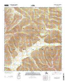
2013 Map of Tanacross B-2 NW
USGS Topo · Published 2013About this map
Ladue River meanders across this interior Alaskan landscape, creating a complex network of oxbows and wetlands in the southeastern portion of the quadrangle. The terrain is defined by significant elevation changes, with ridges rising sharply from the river valley. Surveyed in the early twenty-first century, the map illustrates the uninhabited character of this portion of the Southeast Fairbanks region. The cartography focuses on the intricate contour lines that detail the upland slopes and the hydrological patterns of the Ladue River basin, reflecting a wilderness environment where natural drainage and topography are the primary features of interest.
Find a feature on this map
4 named features on this map. Tap any name to fly to it.
Don’t see what you’re looking for? This feature index may not catch every label — zoom into the map to look around manually.
Map Details
Editions of this 2013 Tanacross B-2 NW Map
This is the sole edition of this map. No revisions or reprints were ever made.
Other maps of this area

1948 · Tanacross B-3
USGS Topo · 1:63,360

1949 · Tanacross
USGS Topo · 1:250,000

1949 · Tanacross B-3
USGS Topo · 1:63,360

1950 · Tanacross
USGS Topo · 1:250,000

1952 · Tanacross B-3
USGS Topo · 1:63,360

1956 · Tanacross C-3
USGS Topo · 1:63,360

1956 · Tanacross C-2
USGS Topo · 1:63,360
1956 · Tanacross B-2
USGS Topo · 1:63,360

1956 · Tanacross
USGS Topo · 1:250,000

1964 · Tanacross
USGS Topo · 1:250,000