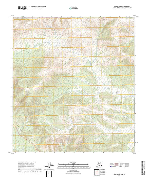
2024 Map of Tanacross B-3 SW
USGS Topo · Published 2024About this map
The Ladu River winds through this interior Alaskan landscape, which remains largely dominated by its natural hydrography and wetland systems. While much of the terrain is defined by the elevation contours of the Tanacross region, human infrastructure is present in the southwestern corner where the Alaska Highway cuts across the survey area. This road serves as the primary corridor for transportation through the Southeast Fairbanks Census Area, linking these remote townships to the broader regional network.
Find a feature on this map
6 named features on this map. Tap any name to fly to it.
Don’t see what you’re looking for? This feature index may not catch every label — zoom into the map to look around manually.
Map Details
Editions of this 2024 Tanacross B-3 SW Map
This is the sole edition of this map. No revisions or reprints were ever made.
Other maps of this area

1948 · Tanacross A-3
USGS Topo · 1:63,360

1948 · Tanacross A-4
USGS Topo · 1:63,360

1948 · Tanacross B-3
USGS Topo · 1:63,360

1949 · Tanacross
USGS Topo · 1:250,000

1949 · Tanacross B-4
USGS Topo · 1:63,360

1949 · Tanacross B-3
USGS Topo · 1:63,360

1950 · Tanacross
USGS Topo · 1:250,000

1951 · Tanacross B-4
USGS Topo · 1:63,360

1952 · Tanacross A-4
USGS Topo · 1:63,360

1952 · Tanacross A-3
USGS Topo · 1:63,360