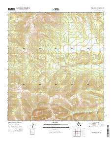
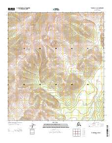
2015 Map of Tanacross C-1 SW
USGS Topo · Published 2015About this map
U.S. Department of the Interior surveyors documented this high-altitude Alaskan wilderness within the Southeast Fairbanks region, capturing a landscape defined by dramatic elevation changes. The survey areas of T21n R21e and T20n R21e dominate the central portion of the sheet, where the Public Land Survey System grid is laid over steep slopes and interior ridges. This map represents a strictly natural environment, devoid of named settlements, roads, or man-made structures, focusing instead on the complex topography and contour data provided by the National Elevation Dataset. It provides researchers with a baseline of the Alaskan interior's physical geography as it existed in the early twenty-first century, emphasizing the vast, uninhabited townships such as T20n R22e and T21n R20e.
Find a feature on this map
5 named features on this map. Tap any name to fly to it.
Don’t see what you’re looking for? This feature index may not catch every label — zoom into the map to look around manually.
Map Details
Editions of this 2015 Tanacross C-1 SW Map
This is the sole edition of this map. No revisions or reprints were ever made.
Other maps of this area

1949 · Tanacross
USGS Topo · 1:250,000

1950 · Tanacross
USGS Topo · 1:250,000

1956 · Tanacross C-1
USGS Topo · 1:63,360
1956 · Tanacross B-1
USGS Topo · 1:63,360

1956 · Tanacross C-2
USGS Topo · 1:63,360
1956 · Tanacross B-2
USGS Topo · 1:63,360

1956 · Tanacross
USGS Topo · 1:250,000

1964 · Tanacross
USGS Topo · 1:250,000
2013 · Tanacross C-2 SE
USGS Topo · 1:25,000
2013 · Tanacross C-2 NE
USGS Topo · 1:25,000