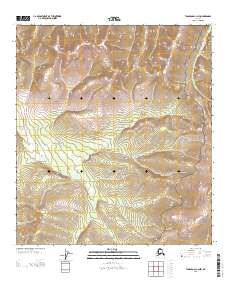
2013 Map of Tanacross C-3 NW
USGS Topo · Published 2013About this map
The Taylor Hwy cuts through the high interior of Southeast Fairbanks, Alaska, serving as the primary corridor for travelers moving between the Alaska Highway and the historic northern goldfields. This 2013 survey provides a detailed look at the drainage patterns along Logging Cabin Cr, which flows through the eastern portion of the quadrangle. The topography is defined by the steep elevation changes of the Tanana Hills, where the road follows the natural contours of the ridges and valleys. While the area remains largely undeveloped, the road itself represents a vital link in the remote northern transportation network, providing access to seasonal mining operations and subsistence lands that have shaped the regional economy for over half a century.
Find a feature on this map
5 named features on this map. Tap any name to fly to it.
Don’t see what you’re looking for? This feature index may not catch every label — zoom into the map to look around manually.
Map Details
Editions of this 2013 Tanacross C-3 NW Map
This is the sole edition of this map. No revisions or reprints were ever made.
Other maps of this area

1949 · Tanacross
USGS Topo · 1:250,000

1950 · Tanacross
USGS Topo · 1:250,000

1956 · Tanacross D-3
USGS Topo · 1:63,360

1956 · Tanacross C-3
USGS Topo · 1:63,360

1956 · Tanacross D-4
USGS Topo · 1:63,360
1956 · Tanacross C-4
USGS Topo · 1:63,360

1956 · Tanacross
USGS Topo · 1:250,000

1964 · Tanacross
USGS Topo · 1:250,000
2013 · Tanacross C-4 NE
USGS Topo · 1:25,000
2013 · Tanacross C-3 SE
USGS Topo · 1:25,000