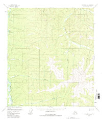
1956 Map of Tanacross D-2
USGS Topo · Published 1981About this map
Dennison Fork and its complex network of tributaries define the high-altitude landscape of this 1956 field-annotated survey in the Alaska interior. The map illustrates a remote wilderness where travel was dictated by seasonal conditions, evidenced by the presence of a Winter Trail navigating the southwestern drainage. Evidence of human activity is scarce, marked only by an isolated Cabin in the northeast near Dewey Creek. Surveyors utilized prominent high points like VABM Atwater 3697 and VABM Paine 4875 29 to map the intricate drainages of Big Timber Creek, Cement Creek, and Gold Bar Creek. The naming of features like Paine Tom Creek suggests a landscape charted by prospectors and trappers who relied on these specific watercourses for navigation and survival before more permanent settlements were established.
Find a feature on this map
11 named features on this map. Tap any name to fly to it.
Don’t see what you’re looking for? This feature index may not catch every label — zoom into the map to look around manually.
Map Details
Editions of this 1956 Tanacross D-2 Map
2 editions found
Other maps of this area

1899 · Fortymile
USGS Topo · 1:250,000

1949 · Tanacross
USGS Topo · 1:250,000

1950 · Tanacross
USGS Topo · 1:250,000

1951 · Eagle
USGS Topo · 1:250,000

1956 · Tanacross D-3
USGS Topo · 1:63,360

1956 · Tanacross C-1
USGS Topo · 1:63,360

1956 · Tanacross D-2
USGS Topo · 1:63,360

1956 · Tanacross C-3
USGS Topo · 1:63,360

1956 · Tanacross C-2
USGS Topo · 1:63,360

1956 · Tanacross D-1
USGS Topo · 1:63,360