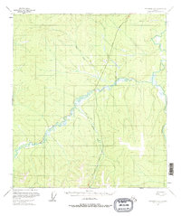
1956 Map of Tanacross D-3
USGS Topo · Published 1977About this map
The Taylor Highway cuts a lone north-south path through this subarctic interior landscape, representing the primary terrestrial link for the region during the mid-1950s. This corridor follows the high ground between significant drainage systems, most notably the West Fork Dennison Fork and Taylor Creek. The presence of a Winter Trail snaking across the northern sections highlights the seasonal nature of travel and subsistence in this environment, where frozen muskeg and rivers often provided more reliable passage than summer terrain. Along the southern reaches, Logging Cabin Creek and the meandering West Fork illustrate the complex water networks that define the local topography. This survey captures a moment when modernized infrastructure began to parallel the older, established paths of the Alaskan interior.
Find a feature on this map
6 named features on this map. Tap any name to fly to it.
Don’t see what you’re looking for? This feature index may not catch every label — zoom into the map to look around manually.
Map Details
Editions of this 1956 Tanacross D-3 Map
3 editions found
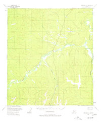
Other maps of this area

1899 · Fortymile
USGS Topo · 1:250,000

1949 · Tanacross
USGS Topo · 1:250,000

1950 · Tanacross
USGS Topo · 1:250,000

1951 · Eagle
USGS Topo · 1:250,000

1956 · Tanacross D-3
USGS Topo · 1:63,360

1956 · Tanacross D-2
USGS Topo · 1:63,360

1956 · Tanacross C-3
USGS Topo · 1:63,360

1956 · Tanacross C-2
USGS Topo · 1:63,360

1956 · Eagle A-2
USGS Topo · 1:63,360

1956 · Tanacross D-4
USGS Topo · 1:63,360