
1951 Map of Tanana
USGS Topo · Published 1952About this map
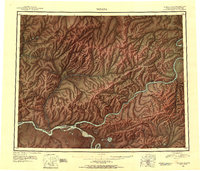
The confluence of the Yukon River and the Tanana River anchors this 1951 study of the Alaskan interior, centered on the settlement of Tanana. The map illustrates a landscape shaped by river transport and mining, featuring the Commercial Airport and Indian Village adjacent to the main town site. Further east, the Yukon River carves through the Ray Mountains, passing The Rapids and the settlement of Rampart. An Agricultural Station (Abandoned) near Rampart suggests early efforts at cultivation in the subarctic climate.
Find a feature on this map
107 named features on this map. Tap any name to fly to it.
Don’t see what you’re looking for? This feature index may not catch every label — zoom into the map to look around manually.
Map Details
Editions of this 1951 Tanana Map
3 editions found
Other maps of this area

1945 · Livengood
USGS Topo · 1:250,000

1948 · Kantishna River
USGS Topo · 1:250,000

1950 · Fairbanks
USGS Topo · 1:250,000

1951 · Kantishna River
USGS Topo · 1:250,000

1951 · Ruby
USGS Topo · 1:250,000

1951 · Fairbanks
USGS Topo · 1:250,000

1951 · Hughes
USGS Topo · 1:250,000

1951 · Melozitna
USGS Topo · 1:250,000

1951 · Bettles
USGS Topo · 1:250,000

1951 · Livengood
USGS Topo · 1:250,000