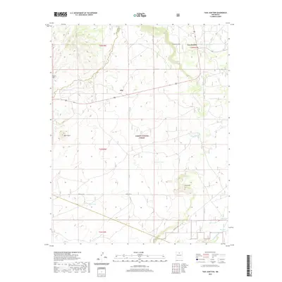
2020 Map of Taos Junction
USGS Topo · Published 2020About this map
Taos Junction and Solo anchor this landscape along the eastern edge of the Carson National Forest, where high-desert terrain meets the foothills of northern New Mexico. The geography is defined by prominent elevations like Cerro Azul and the sprawling Mesa Vibora, intersected by the steep drop of the Comanche Rim. A network of water management features, including Comanche Tank, Vibora Tank, and Kenyon Tank, underscores the area's history of ranching and land use in an arid environment. These earthen tanks, along with seasonal drainages such as Cañon Seco and Cañada Embudo, provided essential water sources for livestock across the rugged mesas. The map also records the boundary line between Rio Arriba and Taos Counties, cutting through the northwest quadrant near the settlement of Solo.
Find a feature on this map
24 named features on this map. Tap any name to fly to it.
Don’t see what you’re looking for? This feature index may not catch every label — zoom into the map to look around manually.
Map Details
Editions of this 2020 Taos Junction Map
This is the sole edition of this map. No revisions or reprints were ever made.
Other maps of this area

1918 · Abiquiu
USGS Topo · 1:125,000

1953 · Lyden
USGS Topo · 1:24,000

1953 · Velarde
USGS Topo · 1:24,000

1953 · Trampas
USGS Topo · 1:24,000

1953 · La Madera
USGS Topo · 1:24,000

1953 · Ojo Caliente
USGS Topo · 1:24,000

1953 · San Juan Pueblo
USGS Topo · 1:62,500

1954 · Raton
USGS Topo · 1:250,000

1954 · Aztec
USGS Topo · 1:250,000

1958 · Raton
USGS Topo · 1:250,000