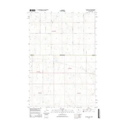
2015 Map of Tatanka Lake
USGS Topo · Published 2015About this map
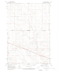
Tatanka Lake and the undulating plains of the Standing Rock Reservation area are defined by a network of seasonal watercourses and remote range roads. This landscape, straddling the North Dakota and South Dakota state line, is dominated by the prominent rise of Leaf-on-the Hill in the northern portion. The map details the drainage patterns of Leaf-on-the Hill Cr and Iron Dog Cr, which carve through the terrain as they flow across the Sioux and Corson County boundary. The sparse infrastructure consists primarily of a rectilinear grid of section-line roads, including 100th St SW and 105th St, reflecting the persistent influence of the Public Land Survey System on this northern prairie environment. The cartography provides a clear view of the open range and scattered wetlands that characterize this border region.
Find a feature on this map
18 named features on this map. Tap any name to fly to it.
Don’t see what you’re looking for? This feature index may not catch every label — zoom into the map to look around manually.
Map Details
Editions of this 2015 Tatanka Lake Map
This is the sole edition of this map. No revisions or reprints were ever made.
Other maps of this area

1953 · McIntosh
USGS Topo · 1:250,000
1954 · Bismarck
USGS Topo · 1:250,000
1956 · Bullhead
USGS Topo · 1:24,000
1956 · Bullhead SW
USGS Topo · 1:24,000
1958 · Bismarck
USGS Topo · 1:250,000

1958 · McIntosh
USGS Topo · 1:250,000
1971 · Shields SW
USGS Topo · 1:24,000
1971 · Lookout Butte SE
USGS Topo · 1:24,000
1971 · Pamplin Hills
USGS Topo · 1:24,000
1972 · Walker
USGS Topo · 1:24,000