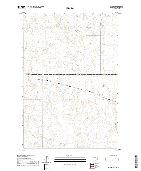
2021 Map of Tatanka Lake
USGS Topo · Published 2021About this map
Leaf-on-Hill stands as a prominent elevation in this northern plains landscape, situated just south of the border where North Dakota meets South Dakota. This 2021 survey by the U.S. Geological Survey details a sparsely populated ranching and agricultural region within the Standing Rock Reservation. The drainage patterns are defined by the winding course of Leaf-on-the-Hill Cr in the north and the multiple branches of Iron Dog Cr to the south. A geometric grid of section lines and rural routes, including Co Rd 718 and 246 St, provides the primary infrastructure for the area. The map illustrates the subtle topography of the Missouri Plateau, where intermittent stream beds and small water pockets are interspersed among the surveyed townships of the Sioux County and Corson County borderlands.
Find a feature on this map
15 named features on this map. Tap any name to fly to it.
Don’t see what you’re looking for? This feature index may not catch every label — zoom into the map to look around manually.
Map Details
Editions of this 2021 Tatanka Lake Map
This is the sole edition of this map. No revisions or reprints were ever made.
Other maps of this area

1953 · McIntosh
USGS Topo · 1:250,000

1954 · Bismarck
USGS Topo · 1:250,000

1956 · Bullhead
USGS Topo · 1:24,000

1956 · Bullhead SW
USGS Topo · 1:24,000

1958 · Bismarck
USGS Topo · 1:250,000

1958 · McIntosh
USGS Topo · 1:250,000

1971 · Shields SW
USGS Topo · 1:24,000

1971 · Lookout Butte SE
USGS Topo · 1:24,000

1971 · Pamplin Hills
USGS Topo · 1:24,000

1972 · Walker
USGS Topo · 1:24,000