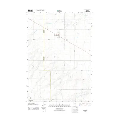
2013 Map of Taunton
USGS Topo · Published 2013About this map
Taunton sits at the intersection of a vast agricultural grid and the rising elevation of the Coteau des Prairies, a dramatic geological feature that dominates the southwestern corner of this survey. The settlement is centered on MN-68, which cuts diagonally across the township-range section lines, connecting the local grain economy to larger regional hubs. The local history and genealogy of the community are anchored at the Old Taunton Catholic Cem and the central Po, which serve as the town's social and historical core. Beyond the town limits, the landscape is defined by the drainage patterns of the Yellow Medicine River and its South Br Yellow Medicine River, which meander through the prairie. This 2013 edition illustrates how the modern road network, including numerous county highways like Co HWY-1, maintains the strict spatial organization of rural Minnesota farming life.
Find a feature on this map
27 named features on this map. Tap any name to fly to it.
Don’t see what you’re looking for? This feature index may not catch every label — zoom into the map to look around manually.
Map Details
Editions of this 2013 Taunton Map
This is the sole edition of this map. No revisions or reprints were ever made.
Other maps of this area

1953 · Watertown
USGS Topo · 1:250,000

1953 · New Ulm
USGS Topo · 1:250,000

1957 · New Ulm
USGS Topo · 1:250,000

1958 · New Ulm
USGS Topo · 1:250,000

1958 · Watertown
USGS Topo · 1:250,000

1963 · Gislason Lake
USGS Topo · 1:24,000

1963 · Lynd
USGS Topo · 1:24,000

1963 · Arco
USGS Topo · 1:24,000

1967 · New Ulm
USGS Topo · 1:250,000

1967 · Minneota
USGS Topo · 1:24,000