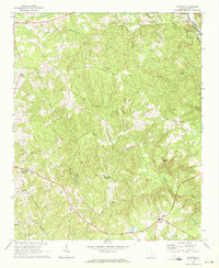
1969 Map of Taxahaw
USGS Topo · Published 1972About this map
Taxahaw and the surrounding rural communities of Lancaster County are defined by a dense network of Piedmont stream valleys and crossroads settlements in the late 1960s. The landscape is heavily dissected by waterways such as Flat Creek, Lick Creek, and Turkey Creek, all draining toward the Lynches River which forms the eastern boundary with Chesterfield County. Settlement patterns follow the high ground between these drainages, anchored by local institutions like New Zion Ch, St Pauls Ch, and Flat Creek Schools.
Find a feature on this map
34 named features on this map. Tap any name to fly to it.
Don’t see what you’re looking for? This feature index may not catch every label — zoom into the map to look around manually.
Map Details
Editions of this 1969 Taxahaw Map
2 editions found
Other maps of this area

1941 · Spartanburg
USGS Topo · 1:250,000

1953 · Spartanburg
USGS Topo · 1:250,000

1960 · Spartanburg
USGS Topo · 1:250,000

1963 · Spartanburg
USGS Topo · 1:250,000

1964 · Spartanburg
USGS Topo · 1:250,000

1967 · Mount Pisgah
USGS Topo · 1:24,000

1968 · Heath Springs
USGS Topo · 1:24,000

1968 · Jefferson
USGS Topo · 1:24,000
1969 · Kershaw
USGS Topo · 1:24,000

1969 · Antioch
USGS Topo · 1:24,000