
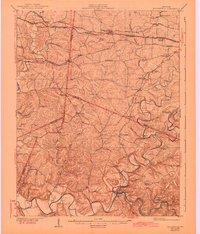
1929 Map of Taylorsville
USGS Topo · Published 1929About this map
Salt River meanders through the southern portion of this region, anchoring the community of Taylorsville as it rests below Blacks Hill. This 1920s landscape is defined by its early transit corridors, notably the Louisville and Shelbyville Interurban and the Southern Railway, which supported agricultural hubs like Simpsonville and Fisherville. The map reveals a dense network of local landmarks essential to rural life, including family-named schools such as Beechwood School and Foreman School.
Find a feature on this map
73 named features on this map. Tap any name to fly to it.
Don’t see what you’re looking for? This feature index may not catch every label — zoom into the map to look around manually.
Map Details
Editions of this 1929 Taylorsville Map
2 editions found
Other maps of this area

1905 · Prospect
USGS Topo · 1:62,500

1907 · Louisville
USGS Topo · 1:62,500

1912 · Prospect
USGS Topo · 1:62,500

1923 · Waddy
USGS Topo · 1:48,000

1925 · Mount Eden
USGS Topo · 1:48,000

1927 · Mount Eden
USGS Topo · 1:62,500

1928 · New Castle
USGS Topo · 1:48,000

1932 · New Castle
USGS Topo · 1:62,500

1932 · La Grange
USGS Topo · 1:62,500

1949 · Samuels
USGS Topo · 1:24,000