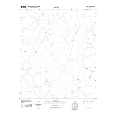
2010 Map of Tee Pee City
USGS Topo · Published 2010About this map
Tee Pee City serves as the focal point of this rangeland landscape in Cottle County, where the Middle Pease River and Tee Pee Creek converge. The terrain is defined by a dense network of ranching infrastructure, characterized by numerous named water sources and pumping stations such as the Dave Harris Windmill, Lone Pole Windmill, and Schweitzer Windmill. These features indicate a sophisticated water management system necessary for livestock in the arid Texas Panhandle environment. Significant landmarks like Bull Pasture Hill and the Red Hills rise above the drainage basins of Sand Creek and Cow Hollow Creek. The map also preserves the locations of vital ranching waypoints, including the Old Headquarters Tank and the Cow Hollow Trap, offering a clear view of the industrial and geographic organization of large-scale cattle operations in the early 21st century.
Find a feature on this map
30 named features on this map. Tap any name to fly to it.
Don’t see what you’re looking for? This feature index may not catch every label — zoom into the map to look around manually.
Map Details
Editions of this 2010 Tee Pee City Map
This is the sole edition of this map. No revisions or reprints were ever made.
Other maps of this area

1954 · Lubbock
USGS Topo · 1:250,000

1954 · Plainview
USGS Topo · 1:250,000

1958 · Plainview
USGS Topo · 1:250,000

1966 · Fields Canyon
USGS Topo · 1:24,000

1966 · Ballard Camp
USGS Topo · 1:24,000

1966 · Cee Vee
USGS Topo · 1:24,000

1966 · Tee Pee City
USGS Topo · 1:24,000

1966 · Devils Canyon
USGS Topo · 1:24,000

1967 · Turtle Hole Camp
USGS Topo · 1:24,000

1968 · Russellville
USGS Topo · 1:24,000