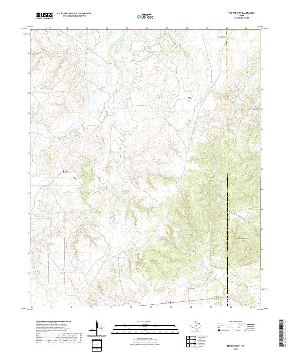
2022 Map of Tee Pee City
USGS Topo · Published 2022About this map
Tee Pee City Cem stands as a quiet marker of local history along the western edge of this territory, where the arid landscape is defined by the winding course of the Middle Pease River. The terrain is etched with numerous named drainages and seasonal water features critical to ranching operations, such as Humpy Tank, New Tank, and the Old Headquarters Tank. These features, along with names like Cow Hollow Trap, reflect a long-standing grazing economy and the vital importance of water management in West Texas.
Find a feature on this map
21 named features on this map. Tap any name to fly to it.
Don’t see what you’re looking for? This feature index may not catch every label — zoom into the map to look around manually.
Map Details
Editions of this 2022 Tee Pee City Map
This is the sole edition of this map. No revisions or reprints were ever made.
Other maps of this area

1954 · Lubbock
USGS Topo · 1:250,000

1954 · Plainview
USGS Topo · 1:250,000

1958 · Plainview
USGS Topo · 1:250,000

1966 · Fields Canyon
USGS Topo · 1:24,000

1966 · Ballard Camp
USGS Topo · 1:24,000

1966 · Cee Vee
USGS Topo · 1:24,000

1966 · Tee Pee City
USGS Topo · 1:24,000

1966 · Devils Canyon
USGS Topo · 1:24,000

1967 · Turtle Hole Camp
USGS Topo · 1:24,000

1968 · Russellville
USGS Topo · 1:24,000