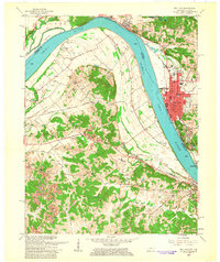
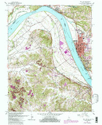
1961 Map of Tell City
USGS Topo · Published 1963About this map
The Ohio River dominates this landscape, serving as the border between Indiana and Kentucky as it winds past Tell City and Hawesville. In the early 1960s, the river-and-rail economy is evident, with the Southern and Louisville and Nashville railroads tracking the shoreline. The Indiana side shows the urban expansion of Tell City, featuring City Hall and several local schools like Newman Sch and Franklin Sch.
Find a feature on this map
50 named features on this map. Tap any name to fly to it.
Don’t see what you’re looking for? This feature index may not catch every label — zoom into the map to look around manually.
Map Details
Editions of this 1961 Tell City Map
5 editions found
Other maps of this area

1900 · St Meinrad
USGS Topo · 1:62,500

1903 · St. Meinrad
USGS Topo · 1:62,500

1903 · Tell City
USGS Topo · 1:62,500

1934 · Cannelton
USGS Topo · 1:62,500

1949 · Cannelton
USGS Topo · 1:24,000

1953 · Cannelton
USGS Topo · 1:24,000

1953 · Lewisport
USGS Topo · 1:24,000

1953 · Cloverport
USGS Topo · 1:24,000

1953 · Tell City
USGS Topo · 1:24,000
1953 · Maceo
USGS Topo · 1:24,000