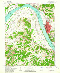
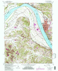
1961 Map of Tell City
USGS Topo · Published 1972About this map
The Ohio River dominates this mid-century view of the borderlands between Indiana and Kentucky, where the river's winding course defines the industrial and agricultural rhythm of the valley. On the Indiana side, Tell City appears as a densely developed river port, centered around key civic structures like the City Hall and Memorial Hospital. Across the water, the Kentucky shoreline near Hawesville is marked by a more rural distribution of family names and small settlements such as Petri and Adair.
Find a feature on this map
51 named features on this map. Tap any name to fly to it.
Don’t see what you’re looking for? This feature index may not catch every label — zoom into the map to look around manually.
Map Details
Editions of this 1961 Tell City Map
5 editions found
Other maps of this area

1900 · St Meinrad
USGS Topo · 1:62,500

1903 · St. Meinrad
USGS Topo · 1:62,500

1903 · Tell City
USGS Topo · 1:62,500

1934 · Cannelton
USGS Topo · 1:62,500

1949 · Cannelton
USGS Topo · 1:24,000

1953 · Cannelton
USGS Topo · 1:24,000

1953 · Lewisport
USGS Topo · 1:24,000

1953 · Cloverport
USGS Topo · 1:24,000

1953 · Tell City
USGS Topo · 1:24,000
1953 · Maceo
USGS Topo · 1:24,000