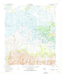
1950 Map of Teller A-1
USGS Topo · Published 1975About this map
Davidsons Landing serves as a northern outpost on this mid-century survey, situated where the Kaviruk River winds through a complex network of wetlands and sloughs. The landscape transition is dramatic, shifting from the wide tidal reaches of the Imuruk Basin and the water-logged lowlands of Lake Omiaktalik to the steep, rising terrain of the Kigluaik Mountains in the south. The settlement of New Igloo is noted near the Pilgrim River, accompanied by a Cem and the older site of Igloo.
Find a feature on this map
20 named features on this map. Tap any name to fly to it.
Don’t see what you’re looking for? This feature index may not catch every label — zoom into the map to look around manually.
Map Details
Editions of this 1950 Teller A-1 Map
2 editions found

Other maps of this area

1950 · Bendeleben A-6
USGS Topo · 1:63,360

1950 · Bendeleben B-6
USGS Topo · 1:63,360

1950 · Nome D-2
USGS Topo · 1:63,360

1950 · Nome
USGS Topo · 1:250,000

1950 · Teller
USGS Topo · 1:250,000

1950 · Bendeleben
USGS Topo · 1:250,000

1950 · Teller A-2
USGS Topo · 1:63,360

1950 · Solomon
USGS Topo · 1:250,000

1950 · Solomon D-6
USGS Topo · 1:63,360

1950 · Nome D-1
USGS Topo · 1:63,360