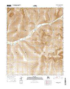
2014 Map of Teller B-1 NW
USGS Topo · Published 2014About this map
Igloo Creek flows centrally through this portion of the Seward Peninsula, anchoring a complex drainage system defined by numerous seasonal and perennial tributaries. The landscape is marked by the sharp relief of unnamed peaks separated by deep creek valleys, including Black Creek and Mascot Cr in the northwest. This terrain, typical of the interior near Nome, shows the intricate natural boundaries of the t1n r33w and t1n r32w townships. South of the main Igloo drainage, the land rises toward a divide where Ruby Cr and Lone Cr originate, illustrating the watershed patterns that shaped early travel and prospecting routes in this part of the Alaska wilderness. The map provides a detailed view of the high-elevation contours and the riparian corridors of Virginia Cr and Hunter Cr, which remain largely untouched by modern infrastructure.
Find a feature on this map
14 named features on this map. Tap any name to fly to it.
Don’t see what you’re looking for? This feature index may not catch every label — zoom into the map to look around manually.
Map Details
Editions of this 2014 Teller B-1 NW Map
This is the sole edition of this map. No revisions or reprints were ever made.
Other maps of this area

1950 · Teller
USGS Topo · 1:250,000

1950 · Teller B-2
USGS Topo · 1:63,360

1950 · Teller B-1
USGS Topo · 1:63,360

1950 · Teller C-2
USGS Topo · 1:63,360
1950 · Teller C-1
USGS Topo · 1:63,360

1951 · Teller
USGS Topo · 1:250,000

1957 · Teller
USGS Topo · 1:250,000

1958 · Teller
USGS Topo · 1:250,000
2014 · Teller B-1 NE
USGS Topo · 1:25,000
2014 · Teller B-2 SE
USGS Topo · 1:25,000