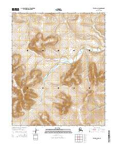
2014 Map of Teller C-2 NW
USGS Topo · Published 2014About this map
The American River carves a central path through this subarctic wilderness on the Seward Peninsula, defining the topographic character of the region. This 2014 survey documents the watershed where the river meanders through broad valleys and steep slopes, particularly notable within the boundaries of t4n r35w, t4n r34w, t3n r35w, and t3n r34w. The landscape represents a modern look at a region where natural drainage patterns and land-survey townships remain the primary markers of human organization in an otherwise undeveloped territory.
Find a feature on this map
5 named features on this map. Tap any name to fly to it.
Don’t see what you’re looking for? This feature index may not catch every label — zoom into the map to look around manually.
Map Details
Editions of this 2014 Teller C-2 NW Map
This is the sole edition of this map. No revisions or reprints were ever made.
Other maps of this area

1950 · Teller
USGS Topo · 1:250,000

1950 · Teller C-3
USGS Topo · 1:63,360

1950 · Teller D-2
USGS Topo · 1:63,360

1950 · Teller D-3
USGS Topo · 1:63,360

1950 · Teller C-2
USGS Topo · 1:63,360

1951 · Teller
USGS Topo · 1:250,000

1957 · Teller
USGS Topo · 1:250,000

1958 · Teller
USGS Topo · 1:250,000
2014 · Teller D-2 SW
USGS Topo · 1:25,000
2014 · Teller C-2 SW
USGS Topo · 1:25,000