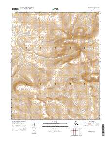
2014 Map of Teller D-2 SW
USGS Topo · Published 2014About this map
The Continental Divide defines the hydrological spine of this high-latitude landscape in the Nome region. This 2014 survey documents the drainage patterns of the Seward Peninsula, where water sheds via Fox Cr and Nugget Cr into distinct coastal basins. The map illustrates a stark, roadless environment characterized by significant elevation changes, where natural landmarks like Portage Cr and Mission Cr serve as primary points of orientation. The lack of human settlement or infrastructure underscores the wilderness character of the territory during the early 21st century. Instead, the map focuses on the precise topographical data and the Public Land Survey System township and range lines, such as t5n r34w, providing a detailed framework for understanding this remote portion of Alaska.
Find a feature on this map
11 named features on this map. Tap any name to fly to it.
Don’t see what you’re looking for? This feature index may not catch every label — zoom into the map to look around manually.
Map Details
Editions of this 2014 Teller D-2 SW Map
This is the sole edition of this map. No revisions or reprints were ever made.
Other maps of this area

1950 · Teller
USGS Topo · 1:250,000

1950 · Teller C-3
USGS Topo · 1:63,360

1950 · Teller D-2
USGS Topo · 1:63,360

1950 · Teller D-3
USGS Topo · 1:63,360

1950 · Teller C-2
USGS Topo · 1:63,360

1951 · Teller
USGS Topo · 1:250,000

1957 · Teller
USGS Topo · 1:250,000

1958 · Teller
USGS Topo · 1:250,000
2014 · Teller C-2 NW
USGS Topo · 1:25,000
2014 · Teller D-2 NE
USGS Topo · 1:25,000