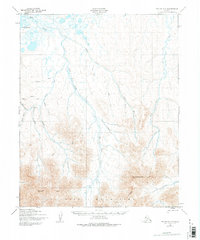
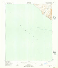
1950 Map of Teller C-5
USGS Topo · Published 1975About this map
The Continental Divide cuts a striking path through this high-latitude terrain, separating the northern coastal plains from the rising peaks of the York Mountains. To the north, the Mint River and Yankee River meander toward the Lopp Lagoon, creating a network of drainage basins that characterize the Seward Peninsula's subarctic landscape. This 1950 survey, mapped by the Army Map Service, documents a region defined by its isolation and topographical complexity. A lone Landing Strip serves as the primary connection to the outside world, situated near the confluence of Whitehorse Creek and Tapioca Cr. The terrain is deeply incised by numerous waterways named by early prospectors and explorers, including Skookum Creek, Ophir Creek, and Mariposa Cr. The presence of Brooks Mountain in the southeast dominates the horizon, marking the rugged transition toward the Lost River valley.
Find a feature on this map
24 named features on this map. Tap any name to fly to it.
Don’t see what you’re looking for? This feature index may not catch every label — zoom into the map to look around manually.
Map Details
Editions of this 1950 Teller C-5 Map
2 editions found
Other maps of this area

1950 · Teller
USGS Topo · 1:250,000

1950 · Teller B-4
USGS Topo · 1:63,360

1950 · Teller C-6
USGS Topo · 1:63,360

1950 · Teller D-5
USGS Topo · 1:63,360

1950 · Teller C-4
USGS Topo · 1:63,360
1950 · Teller D-6
USGS Topo · 1:63,360
1950 · Teller B-5
USGS Topo · 1:63,360
1950 · Teller D-4
USGS Topo · 1:63,360

1950 · Teller C-5
USGS Topo · 1:63,360
1950 · Teller B-6
USGS Topo · 1:63,360