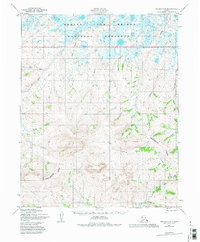
1950 Map of Teller D-2
USGS Topo · Published 1985About this map
The Bering Land Bridge National Preserve spans the northern reaches of this Alaskan terrain, where the Arctic River and Sanguich River drain through a complex network of coastal lowlands. To the south, the landscape rises toward the Continental Divide, a prominent ridge that governs the flow of numerous waterways such as Snowshoe Creek and East Portage Creek. The map documents a sparsely settled wilderness defined by its hydrology, capturing the transition from the upland divides to the marshy flats of the preserve.
Find a feature on this map
19 named features on this map. Tap any name to fly to it.
Don’t see what you’re looking for? This feature index may not catch every label — zoom into the map to look around manually.
Map Details
Editions of this 1950 Teller D-2 Map
3 editions found
Other maps of this area

1950 · Teller
USGS Topo · 1:250,000

1950 · Shishmaref
USGS Topo · 1:250,000

1950 · Teller C-3
USGS Topo · 1:63,360

1950 · Shishmaref A-1
USGS Topo · 1:63,360

1950 · Teller D-2
USGS Topo · 1:63,360

1950 · Teller D-3
USGS Topo · 1:63,360

1950 · Shishmaref A-2
USGS Topo · 1:63,360

1950 · Teller C-2
USGS Topo · 1:63,360

1950 · Shishmaref A-3
USGS Topo · 1:63,360

1950 · Teller D-1
USGS Topo · 1:63,360