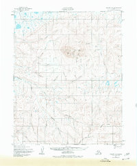
1950 Map of Teller D-3
USGS Topo · Published 1977About this map
Ear Mountain rises as the central landmark of this landscape, its peaks and gulches providing a rugged backdrop to a network of arctic waterways. At the base of the mountain, the Ear Mountain Landing Strip and a solitary Cabin mark the minimal human footprint in this Seward Peninsula terrain during the mid-twentieth century. The Continental Divide winds through the southern reaches of the map, separating the drainage of the Kugrupaga River and Arctic River from the North Fork Nuluk River. This 1950s survey, updated with revisions in the 1970s, captures a remote geography defined by traditional routes like the Winter Trail and named mining-era features such as Idaho Gulch and Step Gulch. The prevalence of small tributary labels like Mizpah Creek and Eldorado Creek points to a legacy of prospectors naming the land one drainage at a time.
Find a feature on this map
33 named features on this map. Tap any name to fly to it.
Don’t see what you’re looking for? This feature index may not catch every label — zoom into the map to look around manually.
Map Details
Editions of this 1950 Teller D-3 Map
3 editions found
Other maps of this area

1950 · Teller
USGS Topo · 1:250,000

1950 · Shishmaref
USGS Topo · 1:250,000

1950 · Teller C-3
USGS Topo · 1:63,360

1950 · Teller D-2
USGS Topo · 1:63,360

1950 · Teller D-3
USGS Topo · 1:63,360

1950 · Shishmaref A-2
USGS Topo · 1:63,360

1950 · Teller C-4
USGS Topo · 1:63,360

1950 · Teller C-2
USGS Topo · 1:63,360
1950 · Shishmaref A-4
USGS Topo · 1:63,360

1950 · Shishmaref A-3
USGS Topo · 1:63,360