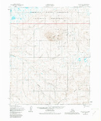
1950 Map of Teller D-3
USGS Topo · Published 1982About this map
Ear Mountain dominates this remote landscape, rising as a distinct landmark with its East Peak and West Peak crests. This area, largely encompassed by the Bering Land Bridge National Preserve, shows the Seward Peninsula's drainage patterns as they existed in the mid-20th century. The Continental Divide winds through the southeastern portion of the map, separating waters that flow toward the Chukchi Sea from those heading inland.
Find a feature on this map
38 named features on this map. Tap any name to fly to it.
Don’t see what you’re looking for? This feature index may not catch every label — zoom into the map to look around manually.
Map Details
Editions of this 1950 Teller D-3 Map
3 editions found
Other maps of this area

1950 · Teller
USGS Topo · 1:250,000

1950 · Shishmaref
USGS Topo · 1:250,000

1950 · Teller C-3
USGS Topo · 1:63,360

1950 · Teller D-2
USGS Topo · 1:63,360

1950 · Teller D-3
USGS Topo · 1:63,360

1950 · Shishmaref A-2
USGS Topo · 1:63,360

1950 · Teller C-4
USGS Topo · 1:63,360

1950 · Teller C-2
USGS Topo · 1:63,360
1950 · Shishmaref A-4
USGS Topo · 1:63,360

1950 · Shishmaref A-3
USGS Topo · 1:63,360