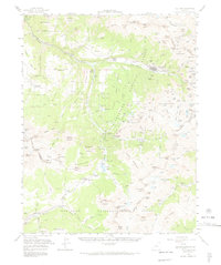
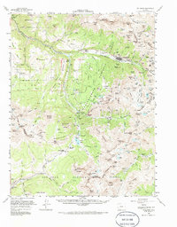
1955 Map of Telluride
USGS Topo · Published 1972About this map
The high-altitude mining district surrounding Telluride is documented here during the mid-1950s, a period when the industrial landscape of the San Juan Mountains was clearly etched into the terrain. The map traces the winding route of the Rio Grande Southern Railroad as it navigates the steep grades through Ophir Loop and Vance Junction. The extensive mining infrastructure of the era is evident in the numerous tunnels and claims dotting the basins, including the Smuggler Mine, Liberty Bell Mine, and the Tomboy (Ruins) located high above the San Miguel River.
Find a feature on this map
180 named features on this map. Tap any name to fly to it.
Don’t see what you’re looking for? This feature index may not catch every label — zoom into the map to look around manually.
Map Details
Editions of this 1955 Telluride Map
5 editions found
Other maps of this area

1897 · Rico
USGS Topo · 1:62,500

1897 · Telluride
USGS Topo · 1:62,500

1897 · Silverton
USGS Topo · 1:62,500

1898 · Engineer Mountain
USGS Topo · 1:62,500

1898 · Rico
USGS Topo · 1:62,500

1899 · Rico
USGS Topo · 1:62,500

1900 · Engineer Mountain
USGS Topo · 1:62,500

1900 · Needle Mountains
USGS Topo · 1:62,500

1901 · Silverton
USGS Topo · 1:62,500

1902 · Needle Mountains
USGS Topo · 1:62,500