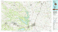
1985 Map of Temple
USGS Topo · Published 1992About this map
Fort Hood Military Reservation dominates the western half of this Central Texas landscape, highlighting a mid-1980s period of significant military infrastructure alongside growing civilian centers. The map documents the sprawling facilities of Robert Gray Army Airfield and the Naval Weapons Industrial Reserve Plant near McGregor, illustrating the region's strategic importance. Between the military grounds and the city of Temple, the waters of Belton Lake and Stillhouse Hollow Lake provided essential flood control and recreation for the expanding populations of Killeen, Harker Heights, and Belton.
Find a feature on this map
137 named features on this map. Tap any name to fly to it.
Don’t see what you’re looking for? This feature index may not catch every label — zoom into the map to look around manually.
Map Details
Editions of this 1985 Temple Map
2 editions found
Other maps of this area

1885 · Taylor
USGS Topo · 1:125,000

1887 · Taylor
USGS Topo · 1:125,000

1887 · Lampasas
USGS Topo · 1:125,000

1887 · Burnet
USGS Topo · 1:125,000

1888 · Hamilton
USGS Topo · 1:125,000

1888 · Meridian
USGS Topo · 1:125,000

1892 · Temple
USGS Topo · 1:125,000

1892 · Waco
USGS Topo · 1:125,000

1893 · Georgetown
USGS Topo · 1:125,000

1893 · Burnet
USGS Topo · 1:125,000