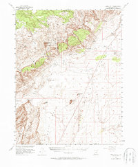
1953 Map of Temple Mtn
USGS Topo · Published 1988About this map
The San Rafael Country landscape shown here reflects a period of intensive uranium exploration in the early 1950s, a joint effort between the Geological Survey and the Atomic Energy Commission. Industrial activity is centered near Temple Mtn, where multiple Tunnels and Shafts are documented along the slopes of the Flat Top Swell. These resource extraction sites are supported by a primitive transportation network of Jeep Trails and a central Landing Strip.
Find a feature on this map
25 named features on this map. Tap any name to fly to it.
Don’t see what you’re looking for? This feature index may not catch every label — zoom into the map to look around manually.
Map Details
Editions of this 1953 Temple Mtn Map
3 editions found
Other maps of this area

1885 · San Rafael
USGS Topo · 1:250,000

1952 · Wild Horse
USGS Topo · 1:62,500

1952 · San Rafael Knob
USGS Topo · 1:62,500

1953 · Stinking Spring Creek 2 SE
USGS Topo · 1:24,000

1953 · Tidwell 2 SW
USGS Topo · 1:24,000

1953 · Tidwell 3 NW
USGS Topo · 1:24,000

1953 · Temple Mtn
USGS Topo · 1:62,500

1954 · Stinking Springs Creek 4 SW
USGS Topo · 1:24,000

1954 · Stinking Spring Creek 1 SE
USGS Topo · 1:24,000

1954 · Stinking Spring Creek 3 SE
USGS Topo · 1:24,000