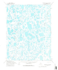
1955 Map of Teshekpuk C-5
USGS Topo · Published 1965About this map
The Topagoruk River meanders through a dense network of thaw lakes and wetlands in this mid-century survey of Naval Petroleum Reserve No. 4. This landscape, shaped by the seasonal rhythms of the Arctic coastal plain, shows the early infrastructure of resource exploration, most notably at the Topagoruk Test Well No 1. Isolated outposts such as Libby and various Cabins indicate the sparse but strategic human presence in the region during the 1950s.
Find a feature on this map
8 named features on this map. Tap any name to fly to it.
Don’t see what you’re looking for? This feature index may not catch every label — zoom into the map to look around manually.
Map Details
Editions of this 1955 Teshekpuk C-5 Map
2 editions found
Other maps of this area

1951 · Meade River
USGS Topo · 1:250,000

1951 · Teshekpuk
USGS Topo · 1:250,000

1955 · Teshekpuk
USGS Topo · 1:250,000
1955 · Teshekpuk B-4
USGS Topo · 1:63,360

1955 · Teshekpuk C-5
USGS Topo · 1:63,360

1955 · Teshekpuk C-4
USGS Topo · 1:63,360
1955 · Teshekpuk B-5
USGS Topo · 1:63,360

1955 · Meade River
USGS Topo · 1:250,000

1955 · Meade River B-1
USGS Topo · 1:63,360

1955 · Meade River C-1
USGS Topo · 1:63,360