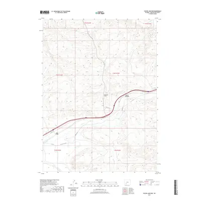
2017 Map of Thayer Junction
USGS Topo · Published 2017About this map
Thayer Junction sits at a critical transit point where modern infrastructure follows the shadow of the historic western migration route. The landscape is defined by the winding course of Bitter Cr and the deeply carved Horsethief Canyon, terrain that once challenged travelers on the Overland Trl. This 2017 survey shows the juxtaposition of contemporary transportation, including I- 80 Svc Rd S, against older landmarks like Salt Wells and the Salt Wells Ranch Rd. The drainage systems of Black Butte Cr and Salt Wells Cr cut through the high desert, illustrating how water sources dictated the placement of ranch roads and early settlements. These features provide a clear view of how the modern Sweetwater County transportation network maintains the alignment established by earlier frontier trails and natural canyon passes.
Find a feature on this map
17 named features on this map. Tap any name to fly to it.
Don’t see what you’re looking for? This feature index may not catch every label — zoom into the map to look around manually.
Map Details
Editions of this 2017 Thayer Junction Map
This is the sole edition of this map. No revisions or reprints were ever made.
Other maps of this area

1908 · Rock Springs
USGS Topo · 1:62,500

1910 · Rock Springs
USGS Topo · 1:62,500

1954 · Rock Springs
USGS Topo · 1:250,000

1958 · Rock Springs
USGS Topo · 1:250,000

1958 · Boars Tusk
USGS Topo · 1:62,500

1958 · Superior
USGS Topo · 1:62,500

1962 · Rock Springs
USGS Topo · 1:250,000

1968 · North Baxter
USGS Topo · 1:24,000

1968 · Point Of Rocks SW
USGS Topo · 1:24,000

1968 · Point Of Rocks
USGS Topo · 1:24,000