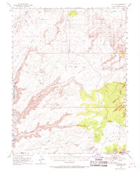
1951 Map of The Knoll
USGS Topo · Published 1968About this map
Green River deepens into Labyrinth Canyon as it carves the western edge of this high desert survey, creating dramatic relief against the surrounding plateau. The landscape is defined by vast mesas and winding drainages like Hell Roaring Canyon and Sevenmile Canyon. Water, the scarcest and most vital resource for 1950s ranchers and early energy prospectors, is meticulously recorded at sites such as Dubinky Well, Dripping Spring, and Horsethief Spr.
Find a feature on this map
69 named features on this map. Tap any name to fly to it.
Don’t see what you’re looking for? This feature index may not catch every label — zoom into the map to look around manually.
Map Details
Editions of this 1951 The Knoll Map
5 editions found
Other maps of this area

1885 · San Rafael
USGS Topo · 1:250,000

1885 · La Sal
USGS Topo · 1:250,000

1951 · The Knoll
USGS Topo · 1:62,500

1951 · Upheaval Dome
USGS Topo · 1:62,500

1952 · Moab 4 NW
USGS Topo · 1:24,000

1952 · Tidwell 4 SE
USGS Topo · 1:24,000

1952 · Moab 3 NE
USGS Topo · 1:24,000

1952 · Carlisle 2 NW
USGS Topo · 1:24,000

1952 · Moab 3 SE
USGS Topo · 1:24,000

1952 · Carlisle 2 NE
USGS Topo · 1:24,000