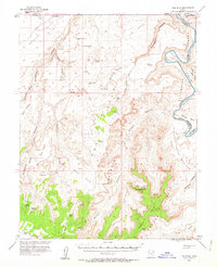
1953 Map of The Spur
USGS Topo · Published 1963About this map
Tidwell Ranch and the isolated landmark The Mailbox anchor this 1953 survey of the remote desert landscape where the Green River carves through Stillwater Canyon. The map reveals a complex system of river bottoms, including Fort Bottom and Anderson Bottom, tucked beneath the towering Orange Cliffs. This terrain, characterized by the prominent plateau of The Spur, contains significant archaeological and geological markers, such as documented Petroglyphs near Barrier Creek and a Natural Arch on the Head of the Spur.
Find a feature on this map
51 named features on this map. Tap any name to fly to it.
Don’t see what you’re looking for? This feature index may not catch every label — zoom into the map to look around manually.
Map Details
Editions of this 1953 The Spur Map
4 editions found

Other maps of this area

1885 · San Rafael
USGS Topo · 1:250,000

1885 · La Sal
USGS Topo · 1:250,000

1951 · The Knoll
USGS Topo · 1:62,500

1951 · Upheaval Dome
USGS Topo · 1:62,500

1952 · Tidwell 4 SE
USGS Topo · 1:24,000

1952 · Carlisle 2 NW
USGS Topo · 1:24,000

1952 · Carlisle 2 SW
USGS Topo · 1:24,000

1952 · Moab 3 SW
USGS Topo · 1:24,000

1953 · Carlisle 3 NW
USGS Topo · 1:24,000

1953 · Orange Cliffs 1 SE
USGS Topo · 1:24,000